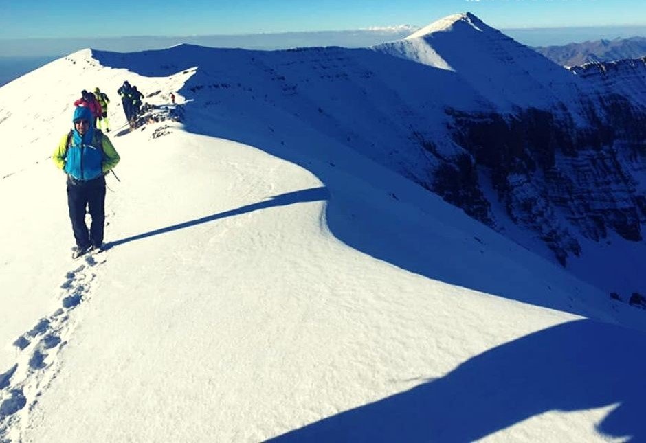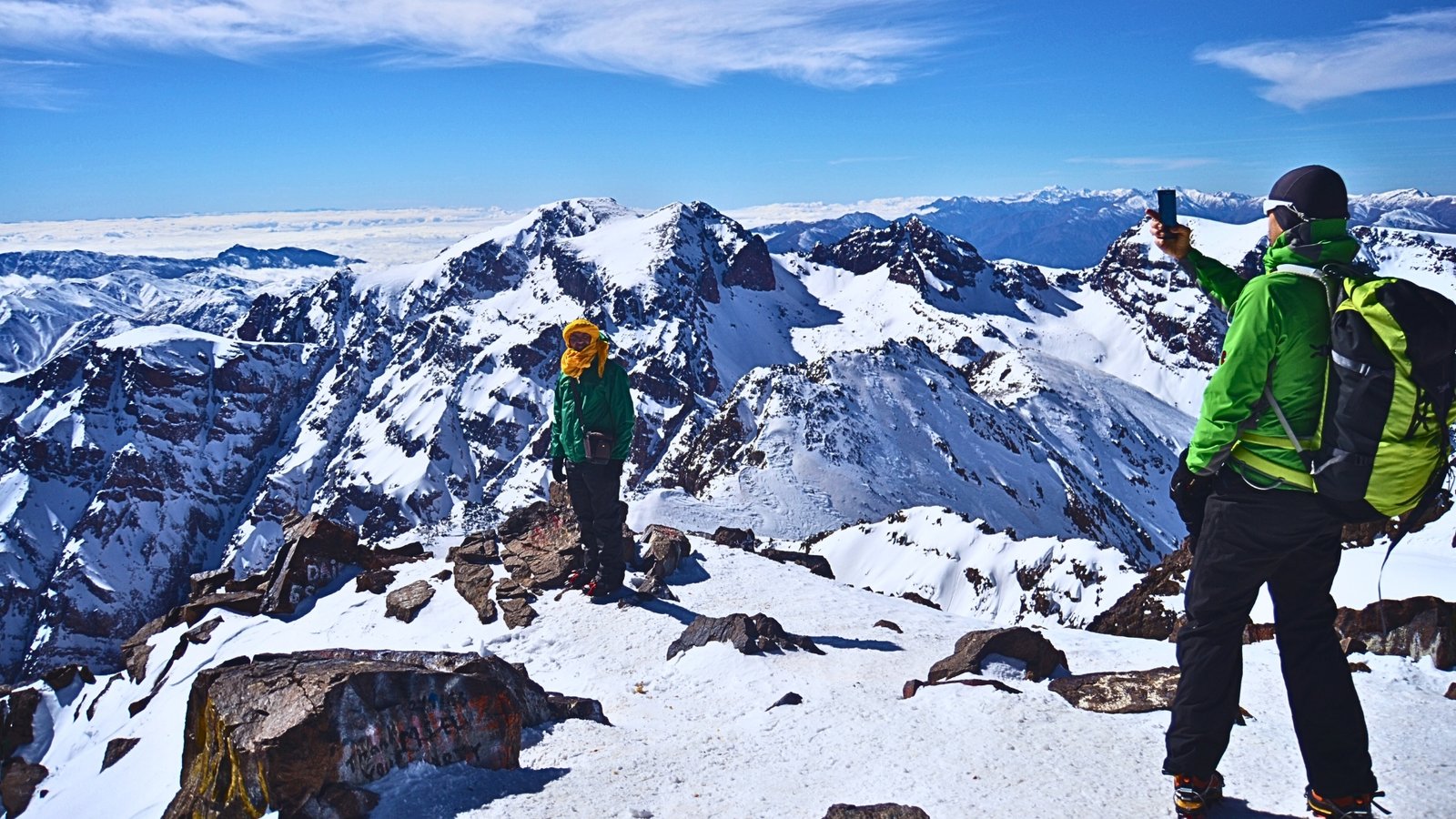
hiking near agadir

Best Hiking Near Agadir: Top Trails, Views, and Day Hikes

Hiking near Agadir is one of the easiest ways to understand why this part of Morocco feels so distinctive. The city itself sits between the Atlantic and foothills of the surrounding mountains, so you do not have to travel far before the urban shoreline gives way to argan country, rocky valleys, dry hills, and greener pockets shaped by seasonal water. The result is a beautiful hiking region that is not defined by one single famous mountain, but variety.

Hiking Near Agadir

With Morocco Hike Tours, a walk around Agadir can mean climbing to a historic viewpoint above the bay, following a palm-lined gorge toward natural pools, or exploring protected coastal landscapes south of the city where dunes, cliffs, and birdlife become part of the experience. The wider Souss-Massa region is promoted precisely for that mix of coast, nature, and mountain scenery, and it is this contrast that makes hiking near Agadir so rewarding.

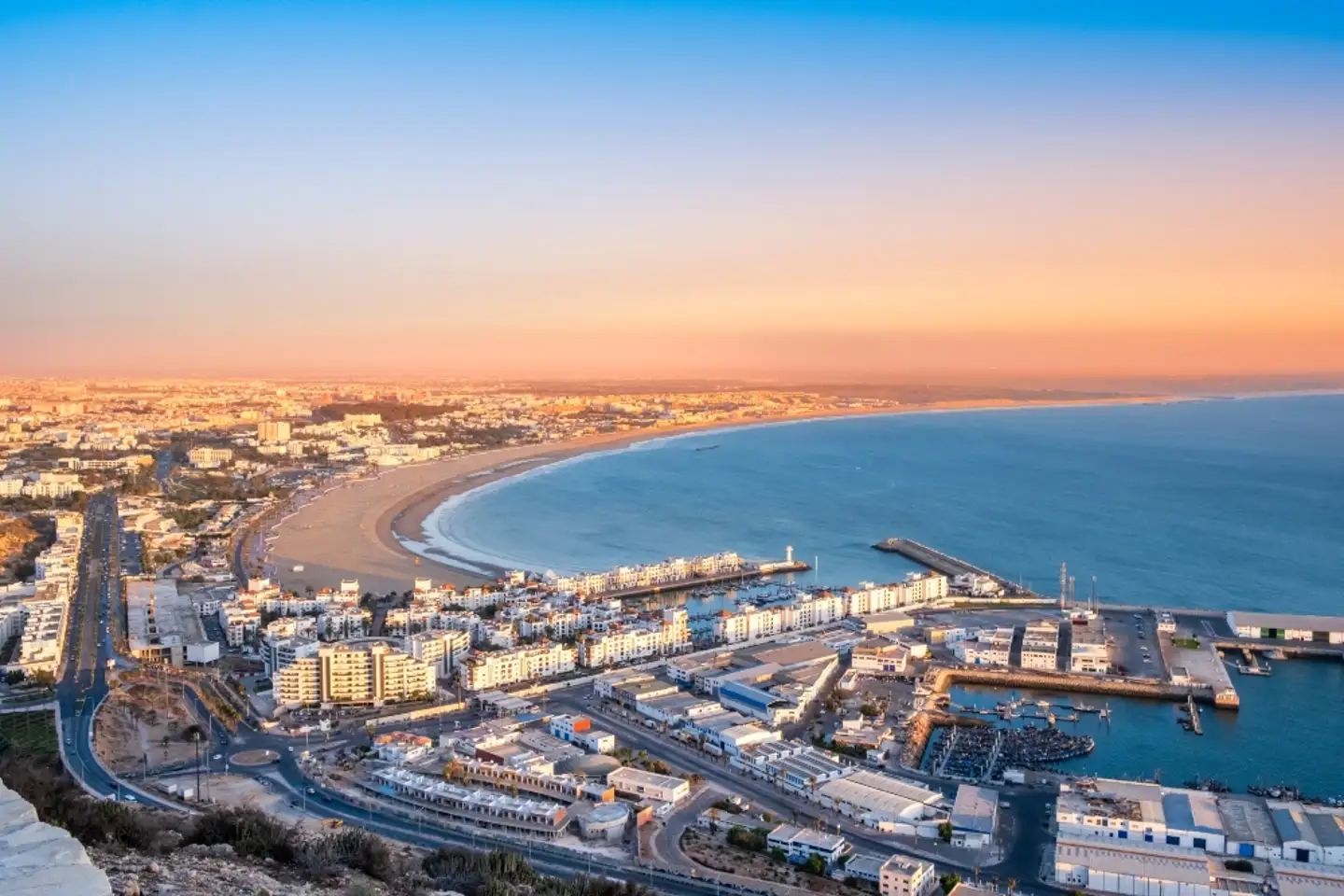
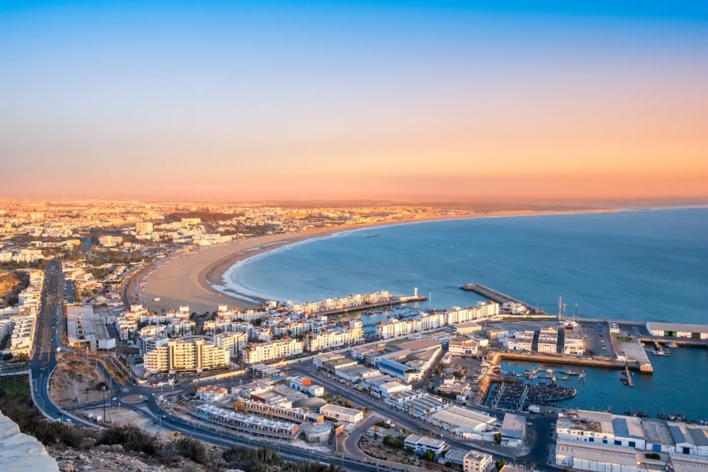
For many visitors, the gentlest hiking near Agadir is the hike to Oufella, the old fortress overlooking the city. This is not a wilderness trek, but it is still a satisfying one because it combines effort, history, and immediate payoff. The official site for the fortress notes a dedicated hiking trail of 2.8 kilometers from the city side, and once you gain height the entire curve of Agadir Bay opens below you. It is the kind of route that works well for people who want a short outing rather than a full day in the mountains.

The setting matters as much as the physical effort about hiking near Agadir. From top, the city appears framed by sea on one side and the dry inland relief on the other, which helps you grasp the geography that shapes all the longer hikes in the region. Since the fortress reopened to visitors in 2024 and is open daily with set visiting hours, it has become an even more practical option for travelers who want a structured, accessible walk close to town.

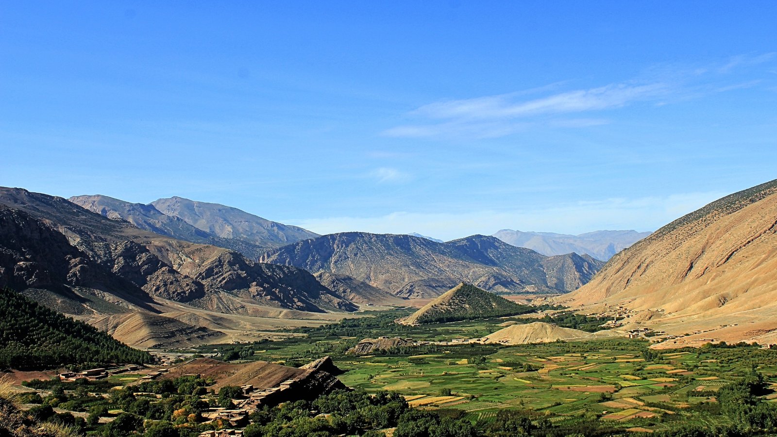
The most talked-about hiking near Agadir is Paradise Valley, in the Ida-Outanane mountain area north of the city. It is part of the valley of the Tamraght River in the foothills of the Western High Atlas, roughly north of Agadir and reachable in less than an hour. The appeal is easy to understand. The valley is known for its natural pools, palm trees, rocky walls, and a route that feels more like moving through an oasis corridor than climbing a peak.

This is one of the reasons Paradise Valley suits such a wide range of walkers seeking hiking near Agadir. You are not going there for alpine drama or extreme altitude, but a landscape that changes gradually as you move deeper into it, with water, shade, stone, and vegetation constantly shifting the mood of the walk. What makes Paradise Valley especially attractive is that it offers both movement and pause. A hike there is rarely just about distance.

Many people walk in, stop at viewpoints or pools, sit in the shade, and continue at an unhurried pace. That rhythm fits the climate and the landscape. In a region where the light can be strong and the ground often dry, the presence of water and palms changes the feel of the day completely. The valley has long been marketed as one of the most pleasant natural excursions for hiking near Agadir, and even that somewhat promotional language points to something true, which is that it is a place where the physical effort remains moderate while the scenery gives a strong sense of escape from the coast.

For travelers based in Agadir or Taghazout, it is often the first place that feels unmistakably mountain Morocco without requiring demanding logistics. If you continue beyond the better-known sections, the road toward Imouzzer des Ida-Outanane adds another layer to the hiking near Agadir. We can highlight Imouzzer for its honey and waterfalls, tying it to an excursion north of Agadir. This area has a more rural, seasonal beautiful character.

In wetter periods, the waterfalls and streams give the landscape extra life, while in drier times, the terrain can feel more austere, with the beauty coming from broad views, terraced slopes, village life, and the sculpted forms of the mountains. Hiking near Agadir there feels less like visiting a single attraction and more moving through a living mountain zone. You notice orchards, beekeeping traditions, villages tucked into folds of the land, and roads that seem to trace old links between communities rather than tourism circuits alone.

South of Agadir, the hiking atmosphere changes again in Souss-Massa National Park, which is located a few miles south of the city, with beaches, dunes, cliffs, argan woodland, and remarkable birdlife, including the northern bald ibis. This is important because hiking near Agadir is not only about mountain trails. Some of the most memorable walking in the area can happen in coastal protected landscapes, where the scale is wide open and the experience is shaped by wind, ocean light, and wildlife rather than elevation gain.

Hiking near Agadir or walking near the park can feel almost meditative compared with a valley. You are moving through space rather than toward a summit, and the rewards come from textures and atmosphere, including line of the cliffs, emptiness of the dunes, abrupt contrast between scrubland and sea. The park is home to a large variety of birds and other wildlife, in addition to Tifnit with its rock faces with inspiring carved cave-dwelling homes.

These details matter because they show that hiking near Agadir can have a cultural and ecological dimension alongside the scenic one. You are not only passing through nature, but walking in landscapes shaped by long human use, local building traditions, grazing patterns, and the famous argan ecosystem of southwest Morocco. Even when a trail seems simple, the region around it tends to carry layers of history and identity that make the walk richer.

Farther afield, those who prefer hiking near Agadir with a bigger sense of scale often look inland toward the Anti-Atlas side of the wider Souss-Massa region. It is a world of pink granite mountains, gorges, secret oases, almond and argan trees. This matters even for people staying in Agadir, because the city is a natural base for day trips or overnight extensions into more rugged terrain. Compared with Paradise Valley, the Anti-Atlas tends to feel drier, more mineral, and spacious.

The paths are often less about water and shade, but also geology, village routes, canyon walking, as well as long views. For stronger hikers, this is where the region begins to show its deeper adventure potential. One of the pleasures of hiking near Agadir is that difficulty can be chosen very freely. A traveler who only wants a morning walk can do the fortress trail or a short outing in Paradise Valley. Someone looking for a more immersive day can combine walking with village stops in the Imouzzer area.

Nature lovers who care less about climbs and more forward habitat and scenery may prefer the southern coastal side around Souss-Massa. More experienced walkers can use Agadir as a launch point into the broader mountain systems of the region. This flexibility makes the area unusually forgiving. You do not need to be a serious trekker to enjoy it, yet there is enough landscape diversity to keep experienced hikers interested. The best attitude for hiking near Agadir is to think in terms of landscapes rather than peak-bagging, as it is a region of transitions, where sea gives way to foothills, and dry hills break open into palm-filled ravines.

Protected coastlines sit close to mountain roads. Historic viewpoints coexist with rural valleys and wildlife zones. That is why hiking near Agadir can feel surprisingly rich even when the routes are not technically difficult. You are constantly moving between different versions of southern Morocco. In practical terms, this also means timing matters. The light of early morning and late afternoon is often the most beautiful, especially on exposed ground, while the greener valleys and seasonal falls are at their most expressive after wetter periods. Even a simple walk becomes more memorable when you choose it for the right landscape at the right time.

Hiking near Agadir is appealing because it feels both accessible and layered. The city offers comfort, beaches, and easy transport, but just beyond it is a network of routes and natural settings that reveal another side of the region. The short climb to Agadir Oufella gives you history and panorama. Paradise Valley offers the classic oasis walk. Imouzzer brings mountain character and rural tradition. Souss-Massa opens the door to protected coastal wilderness. The wider Anti-Atlas hints at longer, rougher adventures beyond the immediate shoreline.

Together, these places make hiking near Agadir more than an activity, but one of Morocco’s most versatile bases for walkers who want scenery, culture, and a sense of movement through varied terrain rather than a single iconic trek.
tassaout

Tassaout Valley in Morocco: A Hidden Gem of the High Atlas

Tassaout, often also spelled Tessaout, is one of those places in Morocco that seems to exist at the meeting point of geography, memory, and endurance. The name refers above all to a river and the valley shaped by it in the High Atlas. The river rises in the mountains, on the northern side of the M’Goun massif, then carves its way through an isolated landscape before descending toward the plains and eventually joining the beautiful Oum Er-Rbia basin.

Tassaout

In the upper valley, Tassaout is known for steep slopes, remote Amazigh villages, terraced cultivation, and a striking palette of red and ochre earth that has given the area a reputation as one of the most visually powerful valleys in the Moroccan Atlas. For Morocco Hike Tours, what makes Tassaout remarkable is not only beauty, but also its sense of enclosure. Many mountain valleys are inspiring, but Tassaout has long been described as especially isolated.

The upper valley is deep in the High Atlas and, for a long time, access depended more on footpaths and mule tracks than on modern roads. That isolation shaped the rhythm of life. Villages developed close to cultivable pockets of land as well as reliable water, and houses were built with local materials in forms adapted to cold winters, strong sun, and steep terrain. Even today, descriptions of the valley emphasize how remote it feels compared with better-known parts of Morocco. It is not simply a scenic place, but a landscape where the architecture and settlement pattern make visible the long effort of human adaptation to the mountain.

The upper Tassaout is also tied to one of the most admired villages in the region, Megdaz, sometimes spelled Magdaz. This village has attracted attention because of preserved Amazigh architecture and its spectacular position on the mountainside. It is built from red clay, stone, and wood gathered from the surrounding environment, with a form that reflects both necessity and inherited craftsmanship. The village is not important only as a picturesque site for travelers, but also as a living example of how communities in the High Atlas organized domestic space, storage, cultivation, and circulation within a difficult mountain setting.

In Megdaz and similar settlements, one can see how houses, paths, terraces, and cultivated plots belong to a single system rather than separate elements. That idea of a whole system is essential for understanding Tassaout. The valley cannot be reduced to mountains and villages alone, but it is also a cultural landscape built around water, seasonal movement, and community organization. A recent study on the landscape and architecture of Magdaz and the Tassaout valley describes mountain life there as traditionally linked to self-subsistence, small settlements, community life, common pastures, transhumance, and seasonal mobility.

In other words, the valley’s social structure emerged from the need to use every available ecological zone. Families cultivated irrigated gardens as well as terraces in the valley floor and lower slopes, while also depending on upland grazing and seasonal movement of herds. This pattern is familiar in many mountain societies, but in Tassaout it remains unusually legible in the layout of the land itself. Agriculture has always been central to the identity of Tassaout. In the broader Tessaout valley, fertile silts washed down from the High Atlas created productive ground, especially where irrigation could be organized.

The valley contains fertile mounds of silt and irrigation was regulated after the completion of the Aït Adel dam in 1971. Elsewhere in the region, olives are especially important. Older scholarly writing on Demnat notes that the slopes of the Tassaout valley carry vines and above all olive trees, with olive oil as a principal product sold on the market. This tells us something important about the valley. Even in an environment that appears austere, rural communities built agricultural systems capable not only of subsistence but also of exchange. The valley was never outside history. Its produce, labor, and routes connected it to nearby towns and plains.

Water management is one of the clearest examples of how Tassaout links mountain ecology to wider regional development. Downstream from the upper valley, the river is controlled by major hydraulic works, including the Moulay Youssef dam, constructed in 1969 upstream on the Tessaout River, with a reservoir intended for irrigation as well as power generation, and the smaller Timinoutine dam built later. The Tassaout Amont irrigation system that followed covered a very large area in the Haouz plain and represented the transformation of river water into organized agricultural infrastructure on a regional scale.

This matters because it shows that Tassaout is not only a remote mountain valley, but also part of a larger story of Moroccan hydraulic planning, state investment, and the redistribution of mountain water toward the plains. Yet this modernization came with complications. A detailed study of the Tessaout Amont irrigation system found that schistosomiasis appeared in the area after the construction of the modern canal network in the early 1970s.

The disease had not been present during centuries of traditional seguia irrigation in the Haouz plain, but hydraulic structures in the new system created ecological conditions favorable to the snail host. Over time, health interventions sharply reduced infection rates, but the episode is significant because it reveals that water engineering is never purely technical. It changes landscapes, habits, and even disease environments. The story of Tassaout therefore includes not just traditional adaptation, but also the unintended consequences of modern development.

Culturally, Tassaout belongs to the Amazigh world of the High Atlas, where oral tradition, architecture, music, and communal practices are deeply tied to place. An interview with the Moroccan composer Ahmed Essyad recalls his discovery of aḥwāš in the Tassaout valley in 1964, showing how the valley forms part of the wider cultural geography of mountain Morocco. This is important because places like Tassaout are sometimes romanticized only as scenic backdrops, when in fact they are generators of artistic and social forms.

The music, collective celebrations, seasonal rituals, and hospitality associated with such valleys are not ornaments added to the landscape, but expressions of long residence in it. There is also a powerful architectural lesson in Tassaout. In many modern settings, architecture is separated from agriculture and daily labor. In the High Atlas, especially in valleys like Tessaout, those domains still overlap. Houses are placed according to slope, sun, access, and storage needs.

Paths connect fields, ovens, water points, and neighboring households. Building materials come from the valley itself. The result is an architecture that appears humble but contains sophisticated knowledge of climate and terrain. The best preserved villages of the upper valley show how beauty can arise from necessity. Their visual power does not come from monumentality, but coherence. They look as though they have grown from the mountain because, in a real sense, they have.

For travelers, Tassaout is often described as one of Morocco’s hidden treasures, but that phrase can be misleading if it suggests an empty wilderness waiting to be discovered. Tessaout is not hidden from the people who have lived there, farmed, crossed with flocks, sung in it, and built villages against its slopes. What makes it special is precisely that it remains inhabited and meaningful. It is a place where one can still read the relationship between water, settlement, isolation, solidarity, landscape and culture with unusual clarity.

In a century marked by rapid urban growth and environmental strain, Tassaout offers a reminder that mountain societies developed forms of resilience based on intimacy with land, careful water use, and strong communal organization. So, to talk about Tassaout is really about more than a valley, but a river descending from the High Atlas, red villages clinging to slopes, terraces and orchards created by patient labor, irrigation that can sustain life as well as reshape it, and about an Amazigh cultural world that still gives the landscape its human depth.

Tassaout stands as one of those rare places where nature and society are not easily separated. The valley is beautiful, but its deeper beauty lies in the fact that it has been made livable, meaningful, and memorable over generations. That is why Tassaout remains one of the most compelling landscapes in Morocco.

6-days-ait-bougmez-valley-trek

Hiking Mgoun Summit trekking

Hiking Mgoun Summit Trekking: Adventure in the High Atlas

hiking mgoun summit trekking from Ait Bougumez valley
M’goun summit
toubkal-trek-atlas-mountain

Imlil village toubkal Atlas

imlil village toubkal summit trek atlas
Atlas Toubkal Summit

Imlil Village Toubkal Atlas: Gateway to the High Atlas

Imlil village, nestled in the heart of the High Atlas Mountains about 65 km south of Marrakech, is a charming Berber settlement and the main starting point for ascents to Mount Toubkal, the highest peak in North Africa (4,167 m). Surrounded by terraced fields, walnut trees, and dramatic peaks, Imlil village is the beating heart of trekking in the Toubkal Atlas region.